Hello Readers,
Its been quite sometime since I started playing with satellites imagery. The world of Satellite Remote Sensing is very fascinating and I confess that I am hooked so much so that I have already penned downs about a dozen case studies to pursue in the coming months.
Most people will be familiar with Google earth platform or even google maps satellite view but Satellites provide much more than just images. With the help of digital image processing we can derive important information to assess the health of our planet and its resources. Satellites sensors are able to sense electromagnetic energy beyond the visible spectrum thus allowing us to sense what our eyes can't see. (ever wondered how in cricket the third umpire is able to tell if the ball hit the bat or no? infrared remote sensing is one of the answer) .
The uses go as far as once imagination can take. If one is interested to know some of the use cases, you may consult this document THE EVER GROWING USE OF COPERNICUS ACROSS EUROPE’S REGIONS .
In the months to come I will be publishing some more articles on remote sensing uses for Goa, India or even updating this one further. Stay tuned. If you have any specific questions feel free to post them in the comments.
Thank you.
Its been quite sometime since I started playing with satellites imagery. The world of Satellite Remote Sensing is very fascinating and I confess that I am hooked so much so that I have already penned downs about a dozen case studies to pursue in the coming months.
Most people will be familiar with Google earth platform or even google maps satellite view but Satellites provide much more than just images. With the help of digital image processing we can derive important information to assess the health of our planet and its resources. Satellites sensors are able to sense electromagnetic energy beyond the visible spectrum thus allowing us to sense what our eyes can't see. (ever wondered how in cricket the third umpire is able to tell if the ball hit the bat or no? infrared remote sensing is one of the answer) .
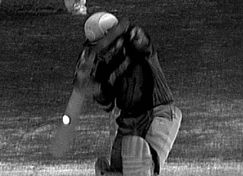 |
| Infrared Remote Sensing to assist the 3rd umpire in Cricket. |
The uses go as far as once imagination can take. If one is interested to know some of the use cases, you may consult this document THE EVER GROWING USE OF COPERNICUS ACROSS EUROPE’S REGIONS .
 |
| Birds Eye View of Salcete Taluka, Goa, India, Captured by Sentinel II satellite on 15/03/2020. |
There are several satellite missions launched by many nations of the world and some of the data is made freely available to the public. One of the freely available best resolution (10 meter) civilian satellite systems are the sentinels developed by the European space agency. This along with various open source software such as QGIS make space intelligence accessible to the common man. Sentinels provide imagery every 5 days which makes it an invaluable asset for monitoring and managing our plant through various applications. .
 |
| This is a false color composite wherein all the vegetation appears red because here instead of red wavelength, infrared(which is reflected by plants) is assigned red color. |
Thank you.


No comments:
Post a Comment